Boat Island
Location
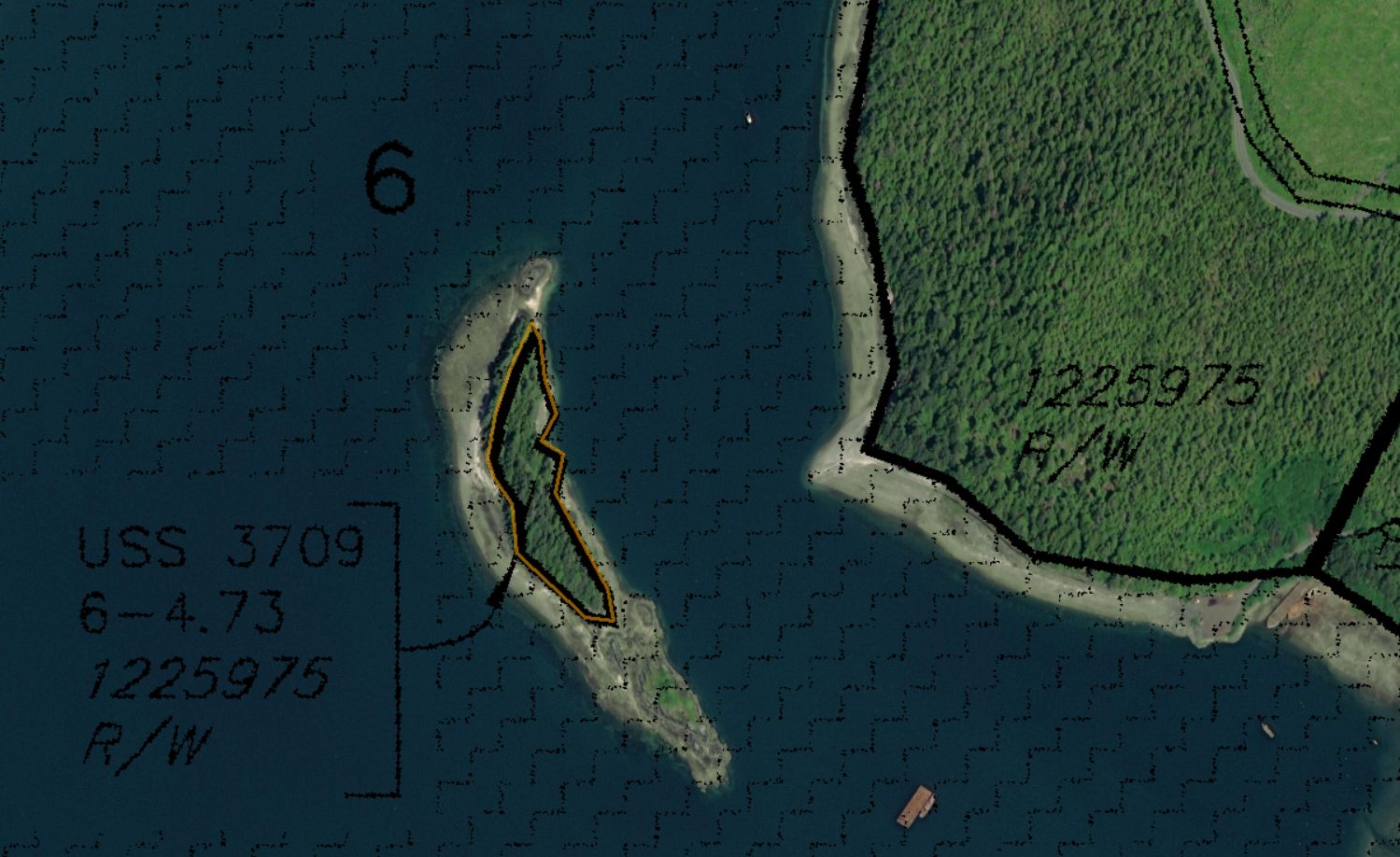
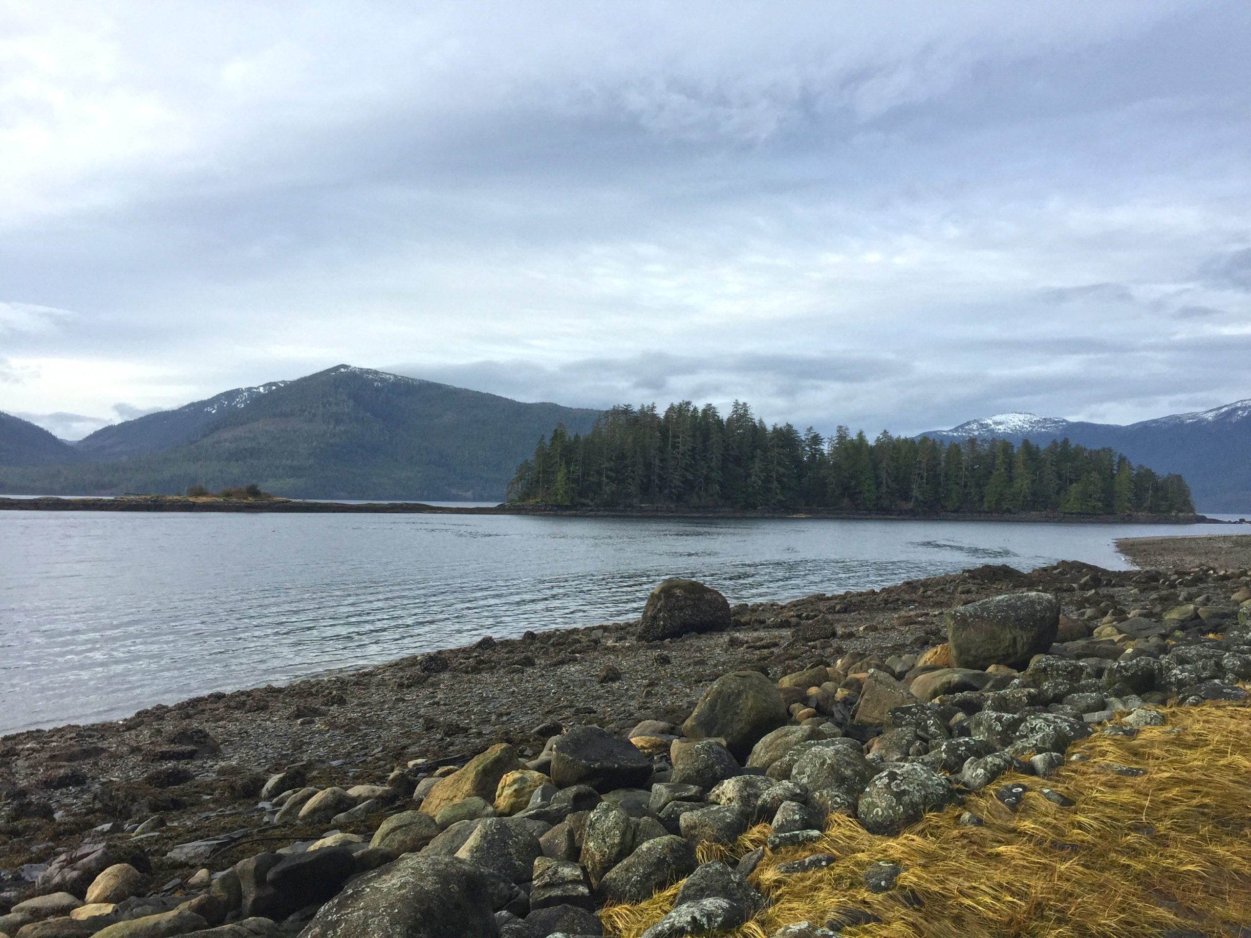
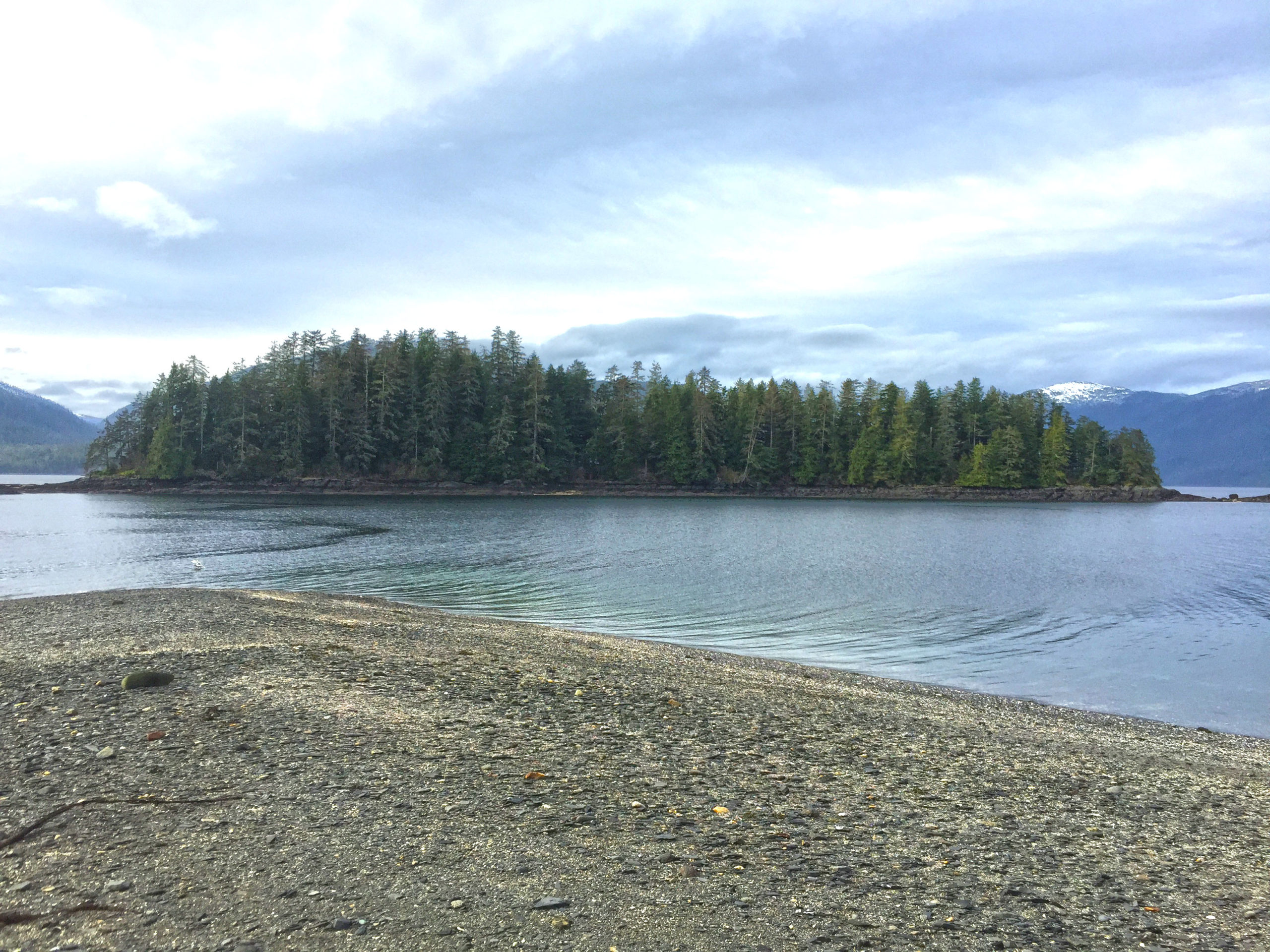
Boat Island is located approximately 10 miles south of the town in the waters of Zimovia Strait (56° 20.8481' N, 132° 21.5434' W). The 4.73-acre island is a short distance from the Wrangell Island mainland, and only accessible by boat or plane. Parking access is gained at Pats Landing located at the end of Pats Creek Road off the Zimovia Highway and provides a good location to park and launch small watercraft for reaching the island, which is only 2,000 feet offshore. The island is forested and undeveloped and serves as an ideal destination for a variety of outdoor recreational opportunities such as fishing, camping, kayaking, and beachcombing, or simply as an escape to enjoy privacy and solitude.
MHT 9100787
- 4.73 acres
- Mental Health Trust Parcel Number: CRM-2530
- City and Borough of Wrangell Tax ID: 03-017-300
- Located in Section 6, Township 64 South, Range 84 East, Copper River Meridian
- Survey: USS 3709, Lot 6
- Minimum Annual Rent Bid: $10,000.00
Open Parcel in Interactive Map
Access
The island parcel is only accessible by boat or aircraft.
View
The parcel has unobstructed views of the surrounding waters of Zimovia Strait and Chichagof Pass, as well as views of nearby Woronkofski Island, Etolin Island, and Wrangell Island.
The parcel is located within the City and Borough of Wrangell and subject to property taxation.
Easements
There are no easements on the subject property.
Water Frontage & Shape
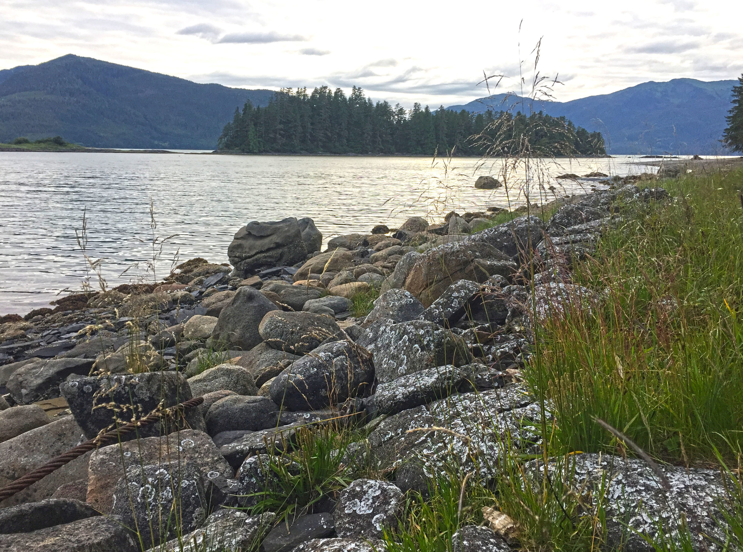
The island is long and narrow, and situated in a north-south direction. The island measures approximately 1,100’ long and 250’ wide. In addition to the parcel a small rocky islet is located at the southern tip of the island that can be accessed by foot during low tides.
Improvements or Trespass
No improvements are located on the island, and there are no known trespass issues.
Public Restrictions
The parcel has not been zoned however it falls within the zoning authority of the City and Borough of Wrangell.
Environmental Restrictions
Subject to Alaska Department of Environmental Conservation regulations for on-site water and waste-water disposal systems
Conservation Restrictions
The parcel is not located within any park or wildlife conservation units.
Private Restrictions
None known.
Other Restrictions
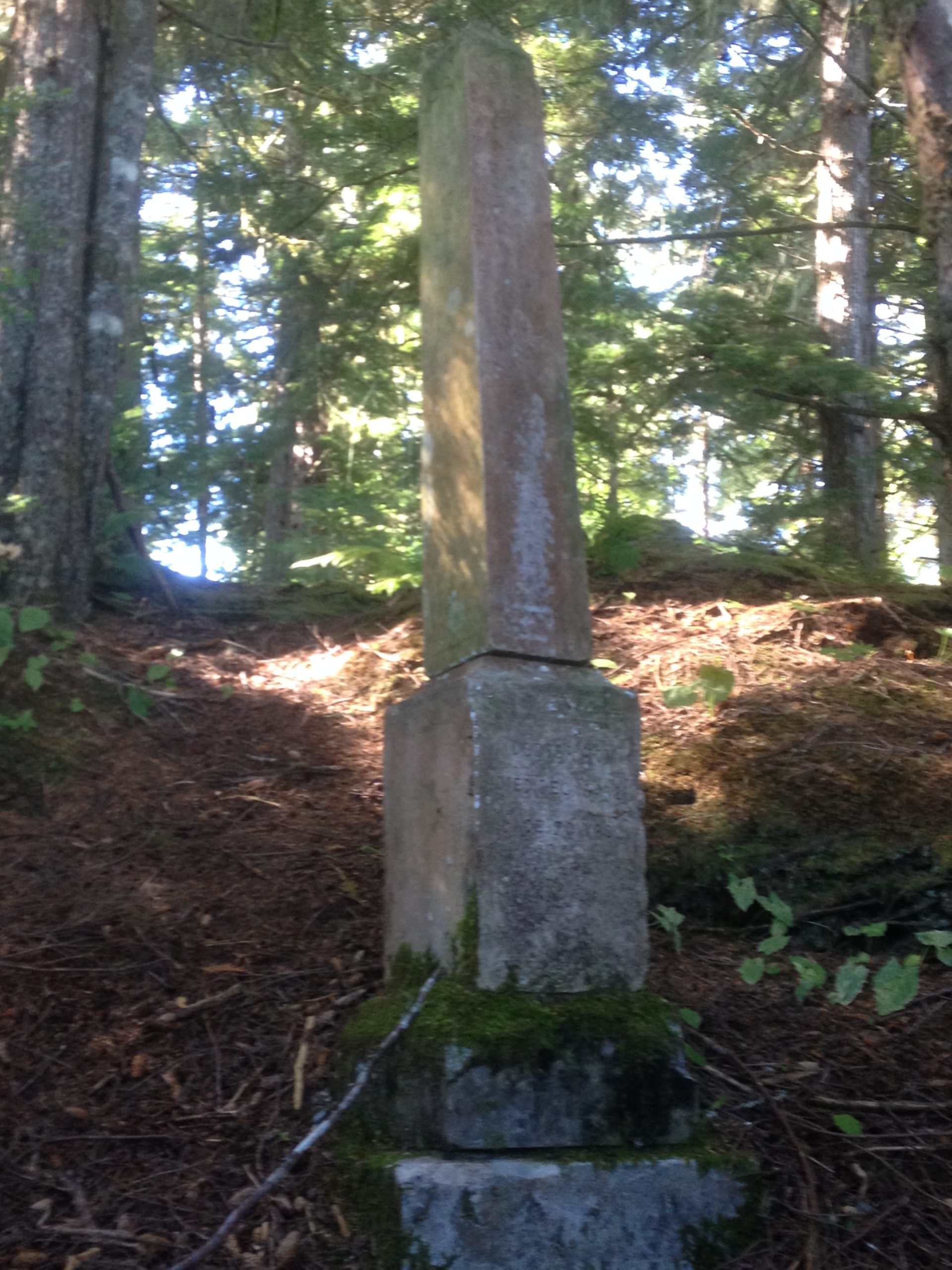
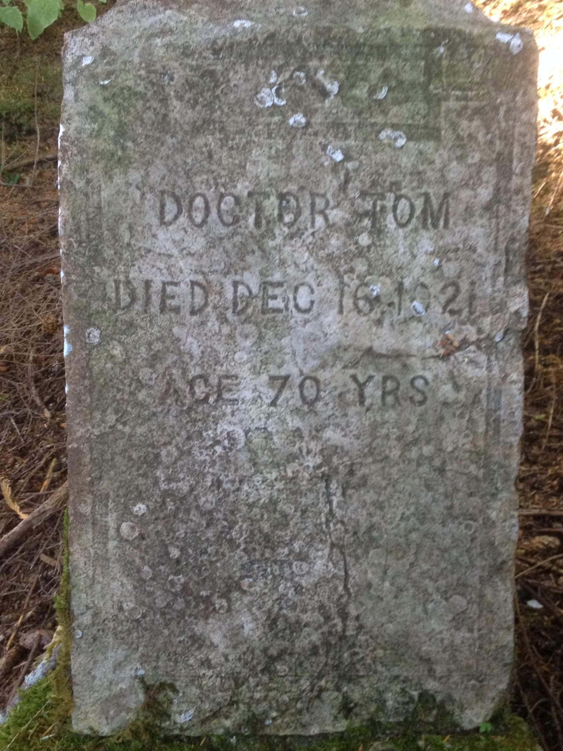
The parcel contains a known historical site (PET-00111) commonly referred to as “Doctor Tom’s Grave”. The grave site is located on the central-east side of the island, and measures approximately 860 square feet and encumbers 0.02 acres. The site was inspected and mapped by an archaeologist in 2016.
Utilities
No public utilities are available to the island. Private individual generators are needed to obtain electricity. Water in the area is typically obtained by private on-site cistern system with roof catchment, and septic will need to be provided on site and meet Alaska Department of Environmental Conservation requirements.
Topography
The subject parcel is moderately to steeply sloping, with a couple of small beaches along the shoreline.
Hydrology
According to the National Wetlands Inventory the parcel contains estuarine and marine wetlands along the shoreline of the island.
Soils
No known soil surveys are reported for this parcel.
Vegetation
The parcel is heavily forested and consists of large Sitka Spruce and Hemlock trees, which is typical of what is found throughout southeast Alaska.
Flood Plain
The parcel appears to be out of any flood plain and above the mean high tide line. According to FEMA there is no data available for the parcel.
Seismic
Current Wrangell area earthquake information is based on best available data obtained from the U.S. Geological Survey (USGS), and the State of Alaska Department of Natural Resources Geological and Geophysical Surveys.
Environmental Issues
None known.
Suitability
The most suitable use of the parcel is for long term private residential use, or outdoor commercial recreation use.
Maps & Survey
Legal description: Section 6, Township 64 South, Range 84 East, Copper River Meridian; USS 3709, Lot 6.
Click to View Survey Plat